The beauty of Mt Gede (2958 mtr/9600 ft) and Mt Pangrango (3019 mtr/9900 ft) is very popular among the climbers, while the diversity of flora and fauna has attracted researchers from two centuries ago. Access to these mountains is very easy, beside Cibodas Botanical Garden at Cipanas, Cimacan which is only 130 km (80 miles) from Soekarno-Hatta airport. Along the track to the top, you will meet an exotic tropical rain forest, waterfalls, hot springs and the blue lagoon. All flora and fauna here are protected by National Park rules.
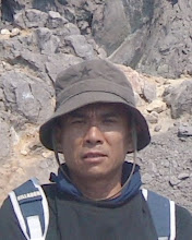
It is possible to climb both mountains in one day, I've done it in 10 hours 35 minutes. Here is my story in climbing at November 8th 2009.
Starting Point-Mt Gede
I started the climbing at 6.00 am from car park area, greeted by the cool and comfortable from the Sub Montana forests. Diverse vegetation with tall and old trees like Rasamala (Altingia Exelsa) which can over 30 meters tall and 300 years old of life, there are also Saninten (Castanopsis Argentea), Puspa (Schima Wallichii) and Jamuju (Dacrycarpus Imbricatus).
A pair of Owa Jawa (Java Gibbon, Hylobates Moloch) was hanging from tree to tree. Java gibbons, including animals that are protected because the population is less and endangered. Deep in the forest is a habitat for various wildlife such as deer, mouse deer, possum, skunk, coyote, and Java Eagle, even panthers and leopards are still found here. Hundreds of bird species became the object of interest to the activities Bird Watching.
6.30 am, arrived at the Blue Lagoon. The blue water is caused by the reflection of sunlight from the blue algae (Spirullina Polycitis). This lake is located 1.5 km from the entrance. About 1.3 km again, there is a way to Cibeureum Waterfall which only 300 meters (0.2 miles) down to right.
7.40 am, arrived at Hot Springs with temperature around 60 degrees Celsius. Be carefull, because climbers must pass the stony track between the hot water.
8.15 am, arrived at Kandang Badak (2400 mtr/7870 ft), a camping ground. A few meters above is a junction, to the left 2.1 km (1.3 miles) is the track to the top of Mt Gede while 3.2 km (2 miles) to the right is to the top Mt Pangrango. The distance between starting point to this junction is 7.5 km (4.6 miles).
 9.35 am, I reached the Top of Mt Gede. Mt Gede is a sleeping active Volcano, it's crater is always smoking with a striped steep wall, like a chiselled white line. Far across the crater, in the north stands gracefully Mt Pangrango. The track was light up with Cantigi (Vaccirium sp) and Edelweiss (Anaphalis Javanica). In the southeast, there is an Edelweiss savana named Alun Alun Suryakencana, from the top it looks like a green carpet. It takes only 20 minutes to go down there, but I didn't go there to save my power.
 I started the trip to Mt Pangrango at 9.55 am by down to Kandang Badak junction, arrived at 10.45 am. Mt Pangrango is an unactive volcano. For those who want to feel the nuances of natural rain forest adventure, here is the place. Humid air and the smell of moss is the atmosphere of Pangrango's forest. So silence, far different with the track of Mt Gede which very famous, Mt Pangrango is less visit by climbers. That day the sun was overhead, but the heat is not felt because of the thick trees. Even the weather remains cool by the tall
trees and moist.
Many large trees laid across the middle of the track. Sometimes I have to crawl out from under, jump or walk on the tree trunk. Large tree roots spread across over there, mingling with the tree trunk. Along the way many branch track, but finally together again. This new track was formed by the flow of water that cuts straight old track. This new track is shorter but steep and slippery, while the old was longer but more gentle slope.
Unlike most mountain peaks that are open, the Top of Mt Pangrango is covered by moss trees tightly enough so I didn't feel when I get on top at 12.10 noon. This peak is marked by a monument 1.5 meters tall and a hut. There was no scenery to be enjoyed because of all sides covered by forest. Between the trees in the south was the top of the cloud-covered Mt Gede. Behind the hut there is Edelweiss savana named Alun Alun Mandalawangi. It takes 10 minutes to come down here. Here is an ideal camping place because there are some vacant land between the trees and water resources few meters at the left end.
 I started to go down at 12.50 and reached Kandang Badak junction again at 2.00 pm.
Finally, I arrived again in parking area at 4.35 pm. Note, my time above is for a person who regularly climb a mountain, for common people could be 2 days. You better take overnight in Kandang Badak camping ground after you down from Mt Gede's top, then next day you continue your trip to Mt Pangrango's top.


